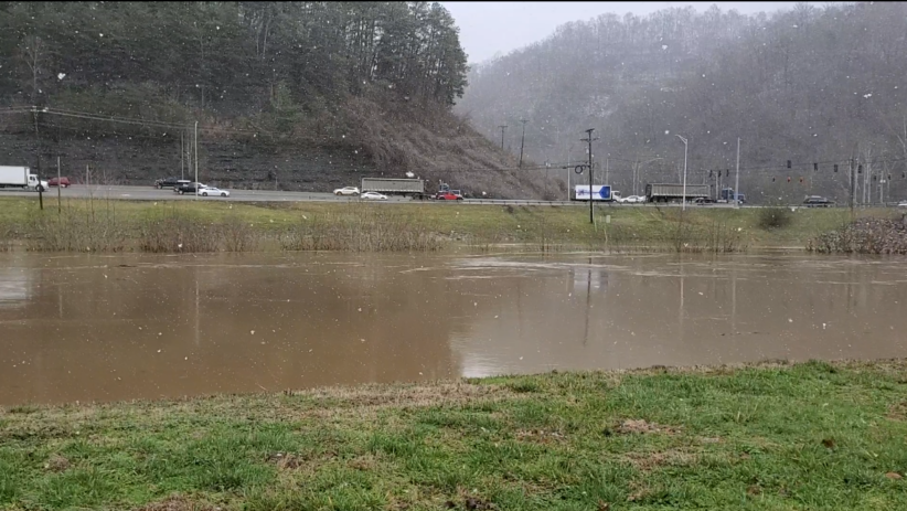
PIKEVILLE, Ky. — With the ground already saturated and heavy rain expected over the weekend, the region is under a flood watch and officials are expecting some minor river flooding to occur in some areas.
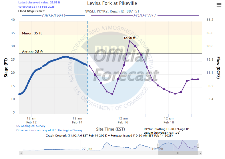
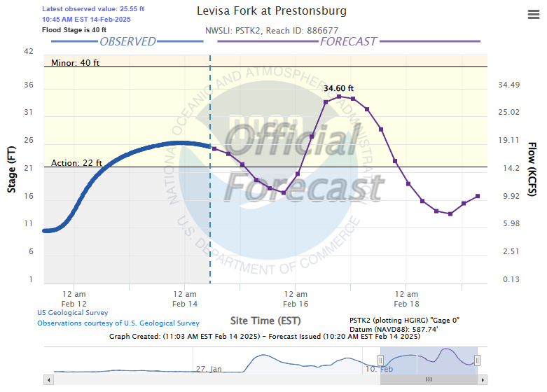
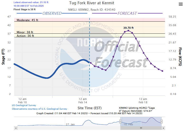
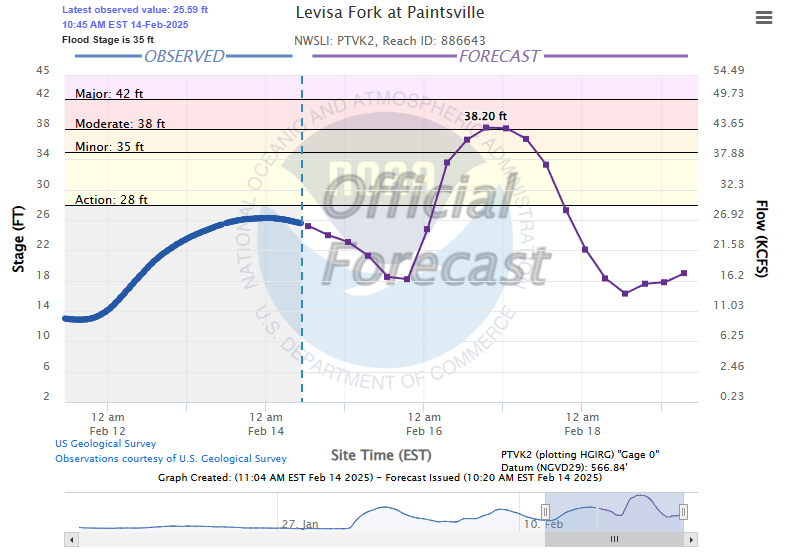
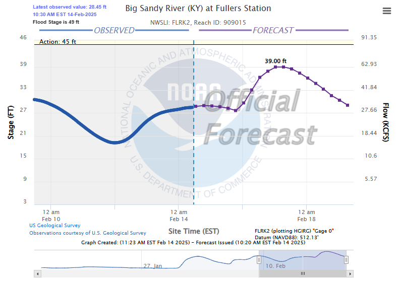
As of 11 a.m. Friday, the National Water Prediction Service is forecasting “minor flooding” Sunday in Williamson and Kermit, while Paintsville could see river levels briefly top at a few inches above “moderate flooding” stage on Sunday, before dropping back to “minor flooding” Monday morning. River levels in Pikeville and Prestonsburg are only supposed to rise to the “action stage.” On down river at Fullers Station, near Louisa, water levels are not projected to rise above normal levels. None of the communities in the immediate area is expected to sustain “major flooding” levels.
A description of each type of flood levels follows:
- Major Flooding — Extensive inundation of structures and roads. Significant evacuations of people and/or transfer of property to higher elevations.
- Moderate Flooding — Some inundation of structures and roads near stream.
- Minor Flooding — Minimal or no property damage, but possibly some public threat.
- Action Stage — The level which, when reached by a rising stream, represents the level where the NWS or a customer/partner needs to take some type of mitigation action in preparation for possible significant hydrologic activity.
Below are current and predicted river levels for communities around the Big Sandy Valley: